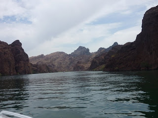
When most people think Arizona, they think of a dry, hot, desert landscape, something along the lines of Phoenix and Tucson. In fact, whenever I tell people I live in Arizona, their first inclination is, “Wow, how do you put up with that heat!” However, having lived in Arizona almost two years now, I can tell you, the reality is that this is a very diverse state with many different climate zones and landscapes. In some ways, it reminds me a lot of Colorado; yes we have a lot of desert, but we also have thick Ponderosa Pine forests, snow covered peaks, spectacular mesas and canyons, we even have a fair amount of agriculture.
The climate here is just as dramatic, and elevation accounts for some tremendous changes in weather. Phoenix, being located at nearly 1,000 feet above sea level experiences stifling heat, with temperatures exceeding 115F on occasion. Phoenix is also very dry, with approximately 7 inches of annual precipitation, and it virtually never snows. Flagstaff, where I live however, is the complete opposite of Phoenix, despite being located only 110 miles north. In Flag, the temperature has never exceeded 97F in our history of record keeping, and most residences do not have air conditioning. Nearly 23 inches of precipitation falls each year, more than 3 times what Phoenix receives (And more rain than Medford, OR for my valley friends), and with over 100 inches of annual snowfall, Flagstaff is one of the snowiest cities in the country. The reason for this dramatic climate difference: Flag’s 7,000 foot elevation. (For reference, the summit of Mount Ashland is 7,532 ft.)
While the lower Arizona deserts experience extreme heat annually, mountainous northern Arizona experiences extreme cold. Just this past winter, January 1st awoke to a bitter cold -30F at Bellemont where the weather office is located, about 10 miles west of Flagstaff. One of our observing sites near Parks, about 20 miles west of Flagstaff registered -40F. Bet you didn’t think Arizona got that cold! It was so cold, we took a video of what boiling water does when it is thrown into -30F air, check it out!
Finally, I attached a graphic depicting the wildly differing elevations of Northern Arizona, and some numbers corresponding to graphics that follow the image. As you can see, the landscape differs dramatically in just short distances, which is part of what makes Arizona such a beautiful state!
1. Flagstaff Arizona - Elevation: 6910 ft. Heavily forested, cool and occasionally snowy, flagstaff defies the reputation of hot and dry Arizona.
2. San Francisco Peaks -Highest Peak Elevation:12,663 ft. Home of Arizona’s tallest peak and largest ski resort, the Arizona Snowbowl.
3. Sedona- Elevation: 4,326 ft. incredible red rocks, cliffs and canyons, and only a short 45 minute drive from Flagstaff.
4. Grand Canyon- Elevation 2,000 ft. at the Colorado River canyon floor, over 9,000 feet at the top of the North Rim.
5. Meteor Crater- Elevation 5,400 ft. Located in the high desert of northeast Arizona, being 40 minutes east of flagstaff the weather becomes very dry and arid, preserving the crater landscape for thousands of years.
6. Far East Arizona- Elevation 5,000- 7000 ft. This desolate region is semi-arid featuring numerous mesas and plateaus as you approach the New Mexico border.
7. Black Canyon city- Elevation 2,000 ft. Less than an hour from downtown Phoenix, this area transisitions sharply from the high desert to the lower desert with Saguaro cactus first appearing in this region.
8. Lake Havasu City- Elevation 735 ft. One of the hottest cities in Arizona, located along the shores of Lake Havasu, the temperature has reached 128F!


No comments:
Post a Comment