All good things must come to end at some point I suppose, and looks like the North American Monsoon season is all wrapped up. However, it went out with a BANG! Cold upper trough camped out across southern California the past 5 days now-which has allowed rich monsoon moisture to interact with some dynamic forcing from the low. The result being pretty vigorous thunderstorm activity. On Sept 12, Flagstaff had one of the biggest hailstorms in recent memory blowing in at 6am of all times, the past several days also witnessed numerous tornado warned supercells with impressive wind velocity structures evident on radar, not the typical weak monsoon storms we are used to seeing. And finally, today, as the low kicked out across the state, cold temperatures aloft, a little wind shear, and some dynamics resulted in a few rotating supercells producing large hail.

Given the end is so near, I took to my afternoon to get one more storm chase in before the dry fall air set in. Storms took off to the southwest of Flagstaff and moved quickly northeast. The initial storm had a strongly rotating though broad cloud lowering, which eventually blew outward into an impressive low hanging gust front. Check out the pic below.

Some small hail followed but the storm weakened rapidly as the gust front blew overhead. Meanwhile, another strong storm blew up to the southwest taking a similar trajectory. This storm intensified very quickly while it approached. I pulled off on Fox Ranch Road and took some pictures. An interesting cloud feature of some kind developed over the freeway as the storm moved just to my north. Very low, rising clouds, not visibly rotating but moving upwards and eastwards very quickly formed in a mater of 60 seconds. Not exactly sure what it signals, cloud be a gust front, low level mesocyclone, both, but in any case...a pretty dramatic storm. There was also some incredible lightning!


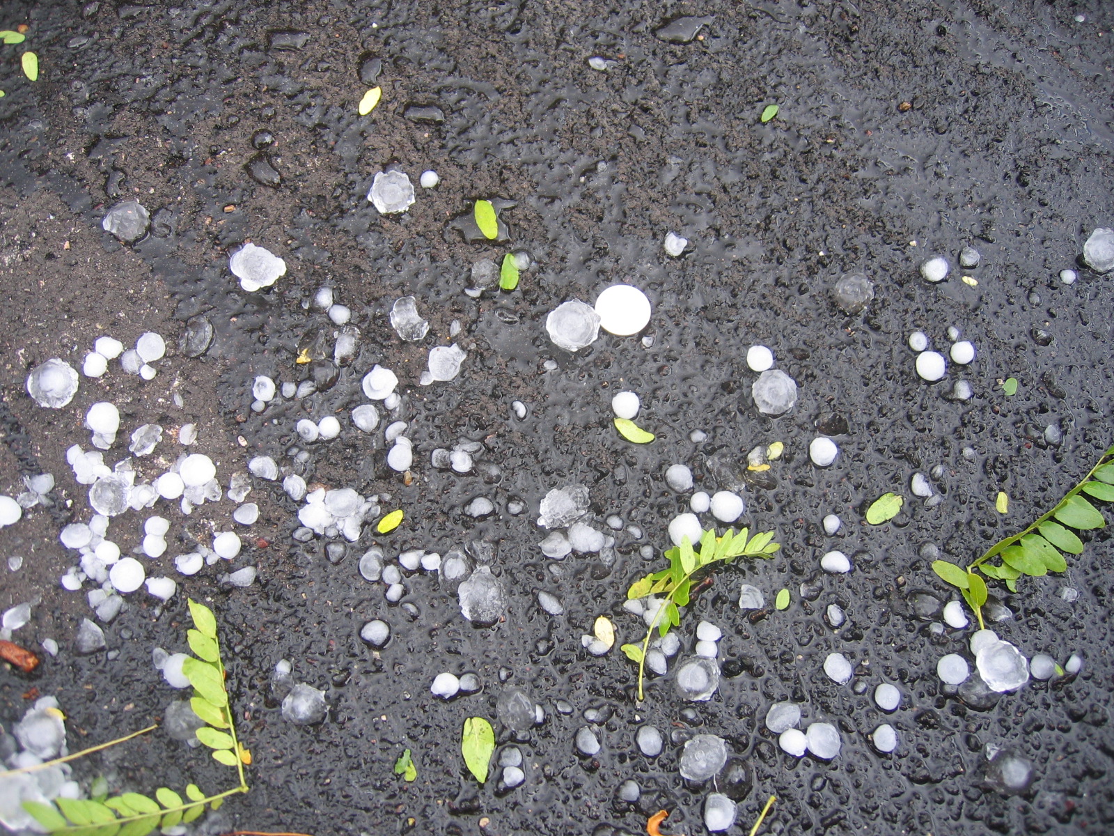
I drove back up the freeway where the storm core had just blown through. I found a 3 or 4 mile from north to south swath of hail extending up to the south edge of Munds Park (Again). Most of the hail was dime to nickel size, with a smattering of Quarter and larger stones. Lots of hard, clear ice stones....so I'm glad I didn't get caught in it with the new Kia, might have ended up with some good dings.
As you can see above, the hail shreded a lot of leaves off the trees and there was a lot of little debris in Munds Park. There may still be a stray storm or two left before winter sets in across the high country, but with dry weather returning next week and the sun angle getting lower by the day...it's becoming less and less likely unless some big storm system comes through to help us out. So I thoroughly enjoyed what the past 5 days brought, and got some great footage as well. If you haven't, check out my lightning video, pretty cool!


Absolutely amazing! I'm so glad you got this weather up there, how fun! And you got to chase around quite a bit and see some great development. GREAT lightning shots!!
ReplyDelete